Pragelpass
The Klöntalersee side from Glarus — Zürich's closest big climb
Overview
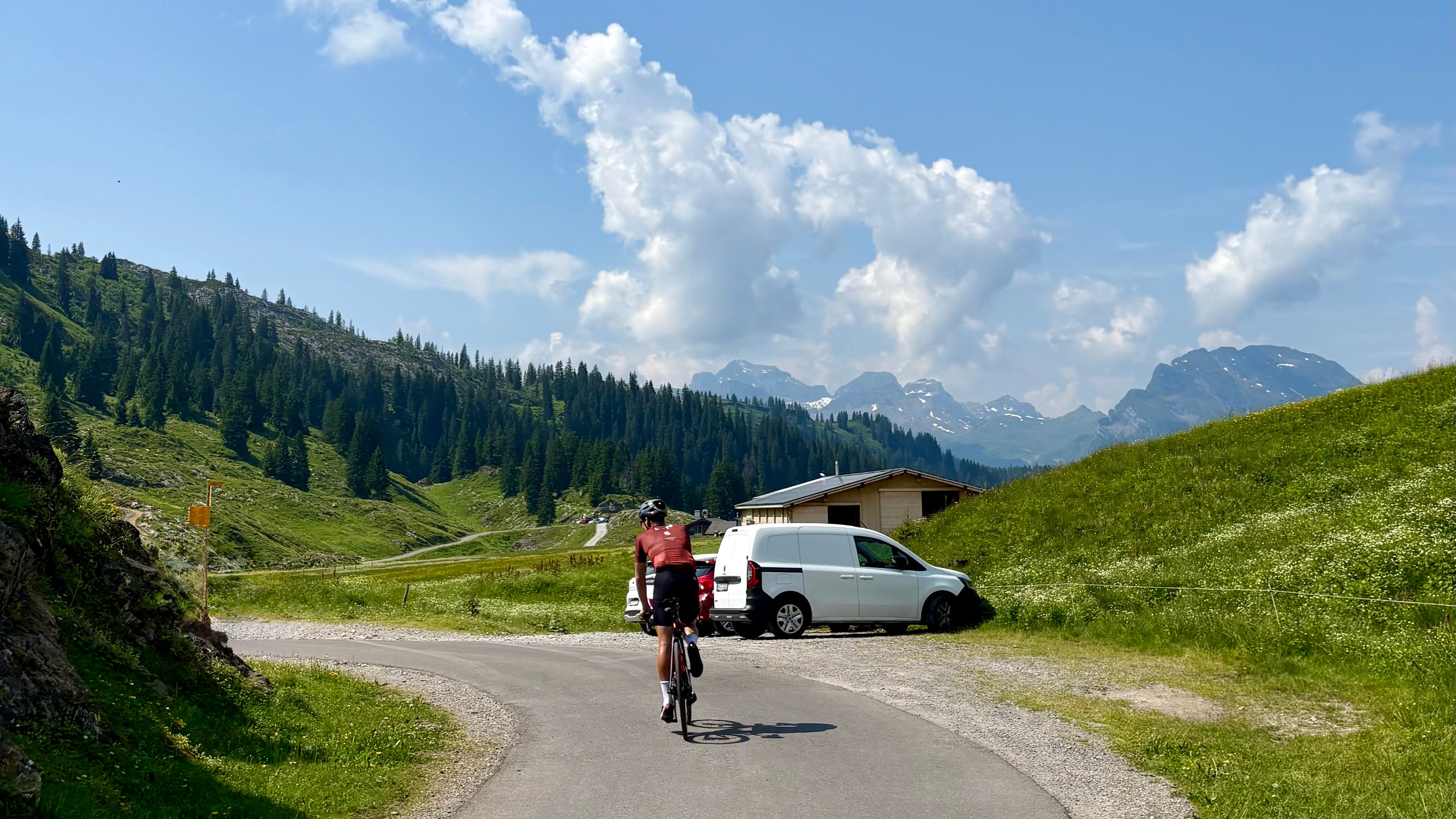
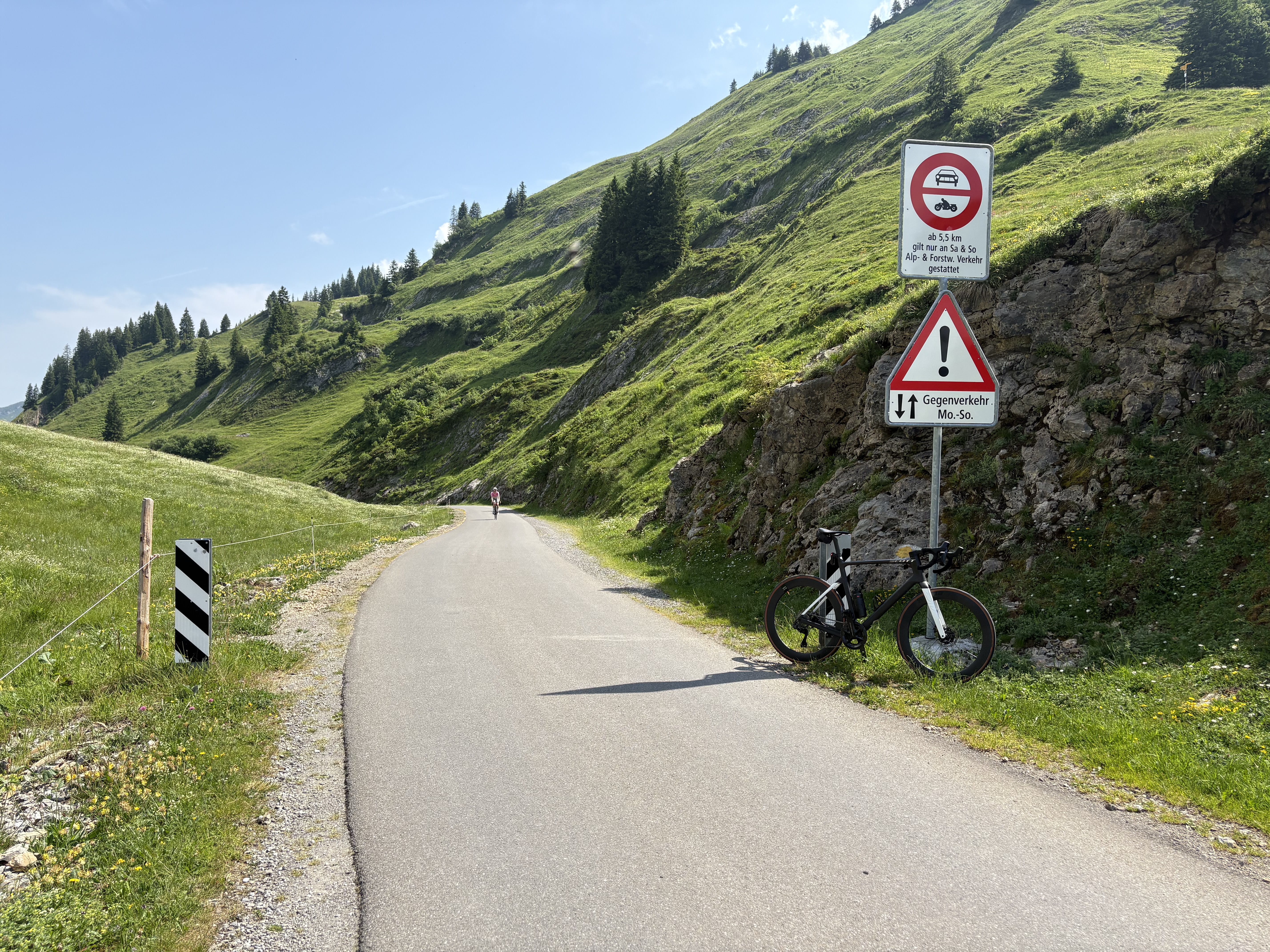
The Pragelpass links the Klöntal in canton Glarus with the Muotathal in canton Schwyz, crossing a quiet 1,548 m col in between. Climbed from the Glarus side — the direction tackled here — it is one of the closest proper mountain passes to Zürich, which is why it shows up so often in the training weeks of riders from the city. The approach is a treat in its own right: the road runs the length of the turquoise Klöntalersee before the serious climbing begins, with the Glärnisch massif rising sheer from the far shore. It is a long, stepped ascent rather than a relentless wall, and where the steep climbing ends it gives way to pure pastoral calm — rolling pasture with green cows and fields of wildflowers running on to the 1,548 m col. The road is closed to cars at weekends, so on a Saturday or Sunday you will have it almost to yourself but for other cyclists; this is a riders' climb.
Key info:
- Total distance: 19.8 km
- Area: Klöntal / Muotathal (Glarus–Schwyz)
- Recommended for: Advanced
- Appeal: One of the closest big climbs from Zürich — a long, stepped ascent past the turquoise Klöntalersee toward a quiet 1,548 m col, with a steep, committing descent to Muotathal
- Water & fuel: A water fountain in Glarus right before the climb starts; a lakeside restaurant to eat at roughly halfway up by the Klöntalersee and a last one right at the top
- Time of year: June–October (closed/snowbound in winter)
- Road: Narrow alpine road, closed to cars at weekends and quiet but for cyclists the rest of the week; the descent to Muotathal is narrow and very steep
Ascent
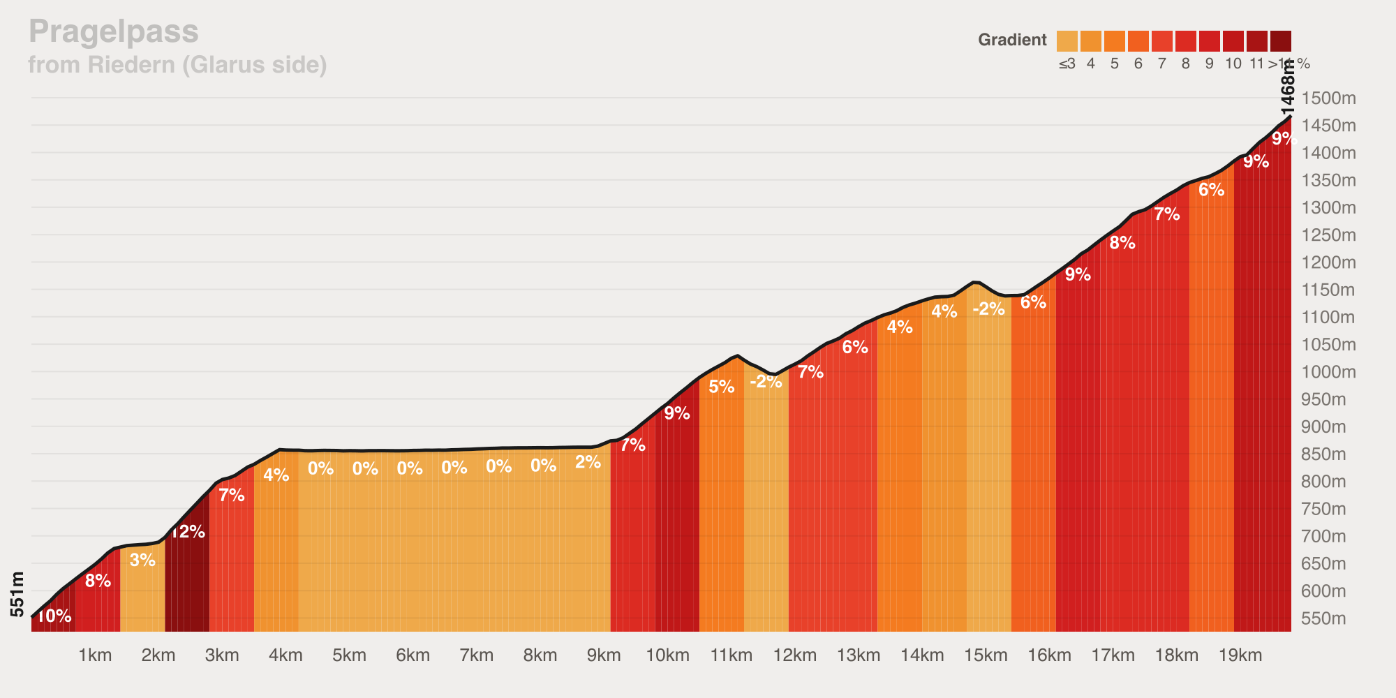
The climb proper starts as you leave Riedern at around 550 m — fill your bottles at the fountain in Glarus first, as it is the last water before the lake. From there it sets off in steps rather than one sustained grind. A first ramp lifts the road up toward the Klöntalersee, touching double digits before easing onto the long, near-flat shelf that runs the length of the lake at around 850 m — a few kilometres of soft-pedalling with the Glärnisch towering across the water. There is a restaurant right by the lake at roughly the halfway point. Past the head of the lake the real work begins: the road tips up again and stays up, holding 8–9% pitches through forest and open pasture. The steep climbing tops out around 1,470 m at 19.8 km, where the gradient finally relents and rolling cow pasture and wildflower meadows carry on to the 1,548 m col and a last mountain restaurant. Measured over the 19.8 km it averages a modest 4.6% — but that figure is flattered by the lakeside shelf in the middle; the climbing sections themselves are a steady intermediate test, ramping to 14% on the steepest 100 m pitches. Long, stepped, and scenic.
Stats:
- Level: Intermediate
- Distance: 19.8 km
- Elevation gain: 979 m
- Maximum gradient: 14%
- Average gradient: 4.6%
- Estimated time (at level): 70 min
Descent
The drop to Muotathal on the Schwyz side is what pushes the day into advanced territory. From the col the road falls fast and hard toward the valley — losing some 927 m over about 12 km at an average near 7.6%, with a steep middle section and a genuine wall touching 15%. The road here is narrow and very steep, with around five true hairpins and many tighter bends; with the pass closed to cars at weekends you will meet far more cyclists than traffic, so hold your line and expect company on the bends. Cold rims and a moment's inattention are not welcome here. The grade only relents once the road reaches the floor of the Muota valley. Strong descending nerve and good brakes are non-negotiable — this is a descent that rewards respect.
Stats:
- Level: Advanced
- Hairpins: 5
- Maximum gradient: 15%
- Average gradient: 7.6%
Climb Profile
A steep first ramp from Riedern up to the Klöntalersee, a long near-flat shelf running the length of the lake around 850 m, then a sustained upper climb holding 8–9% to where the steep work tops out around 1,470 m — 979 m of gain over 19.8 km, before the rolling run-in to the 1,548 m col.
Summary
Climbed from the Glarus side, the Pragelpass is a climb Zürich riders can reach without a long transfer — close to home, yet a genuinely big day in the mountains. The ascent past the Klöntalersee is a long, stepped intermediate effort with one of the prettiest mid-climb shelves in central Switzerland, while the steep descent to Muotathal earns the route its advanced billing. Time it for a weekend, when the pass is closed to cars and all but yours to share with other riders. Ride it as an out-and-back from Glarus, or link it into a Glarus–Schwyz loop (as this 167 km day did). Carry enough to reach the col, and save something in the legs and the hands for the drop into the Muotathal.